A five-story mixed-use project along Market Street hit an unexpected buried channel at 28 feet. The borehole log showed sand, but the actual excavation revealed soft organic silt that wasn't picked up by standard drilling alone. That's when the geotechnical engineer called for a non-invasive electrical resistivity survey. By running a Schlumberger array across the site, we mapped a sharp resistivity contrast at the channel boundary within two hours of field work. In Wilmington, where the Fall Line creates abrupt transitions between Piedmont rock and Coastal Plain sediments, resistivity fills the gaps that point-source borings miss. The VES method measures apparent resistivity at increasing electrode spacings, building a 1D layered model of the subsurface without disturbing the ground. It works particularly well in urban lots along the Christina Riverfront where access is tight and contamination concerns rule out heavy rigs. We integrate the resistivity profile with CPT soundings to calibrate layer boundaries against cone tip resistance, giving the structural engineer a continuous cross-section for foundation design.
In Wilmington's Fall Line transition zone, resistivity soundings map the buried rock surface continuously where borings only give you point data.
Technical details of the service in Wilmington Delaware
Typical technical challenges in Wilmington Delaware
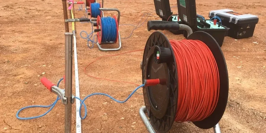
The field setup begins with a 12-volt deep-cycle battery bank and a DC-to-DC converter that steps voltage up to 400 volts for deep penetration. Four stainless steel electrodes are driven 12 inches into the ground along a straight transect, and the crew checks contact resistance at every station before firing the current. In Wilmington's urban environment, the biggest interference source is the 60 Hz noise from overhead power lines along I-95 and Amtrak's Northeast Corridor catenary system. We reject power-line harmonics using a stacking algorithm that averages 4 to 16 readings per measurement cycle until the standard deviation drops below 2 percent. Buried metallic utilities—old cast-iron water mains on Union Street, abandoned trolley tracks in the Hilltop neighborhood—create conductive shorts that distort the apparent resistivity curve. The field geophysicist flags these anomalies during acquisition and either shifts the array offset or models the metallic body as a known layer in the inversion. Without these corrections, a VES sounding can misidentify a corroded pipe as a shallow groundwater table, leading to erroneous dewatering assumptions during excavation design.
Our services
Our Wilmington resistivity services address the specific subsurface challenges of northern Delaware—buried valleys, variable bedrock depth, and saline intrusion along the tidal Christina and Delaware Rivers.
1D Vertical Electrical Sounding (VES)
Single-location depth profiling using expanding Schlumberger array. We log apparent resistivity at 15 to 20 spacing increments, invert the curve to a layered earth model, and deliver a geoelectric column with interpreted lithology, moisture condition, and depth to bedrock. Used for foundation feasibility studies, groundwater exploration, and mapping the rock surface beneath brownfield sites in the Riverfront and Southbridge areas.
2D Electrical Resistivity Tomography (ERT)
Multi-electrode profile lines with 56 or 112 electrodes at 5- to 10-foot spacing. The system auto-sequences through thousands of quadripole combinations, and we invert the full dataset to produce a continuous resistivity cross-section. Applied to locate buried channel margins, delineate contaminant plumes, and assess karst features in the Wissahickon formation. Each profile is topographically corrected using real-time kinematic GPS.
Questions and answers
What depth can a VES sounding reach at a Wilmington site?
Investigation depth depends on the maximum current electrode separation (AB/2) and the subsurface resistivity. With our 400-watt transmitter and an AB/2 of 300 feet, we routinely reach 100 to 150 feet below grade in the Coastal Plain sediments south of the Fall Line. In high-resistivity Piedmont rock north of Wilmington, penetration may be limited to 80 feet because the current struggles to inject into dry crystalline formations. We extend the array length when deeper targets require it.
How much does an electrical resistivity survey cost in Wilmington, Delaware?
A single VES sounding with data processing and a written report typically ranges from US$630 to US$980, depending on access conditions and the number of depth levels required. A 2D ERT profile line costs more because of the higher electrode count and longer field time. We provide a fixed-price proposal after reviewing the site location and the target depth.
Can you run resistivity lines on paved surfaces in downtown Wilmington?
Yes, but with constraints. We use electrode adapters with conductive gel and small-diameter holes drilled through asphalt to reach native soil. Good electrode contact is critical—contact resistances above 2,000 ohms degrade data quality. On concrete pavements with thick aggregate base courses, we may need to use capacitively coupled resistivity systems that don't require galvanic contact, though these have shallower penetration. We assess surface conditions during the site walk before finalizing the survey plan.
How do you distinguish saltwater intrusion from clay layers in resistivity data?
Both saline pore water and marine clay produce low resistivity readings—typically below 5 ohm-m—so the raw VES curve alone can be ambiguous along the tidal Christina River. We resolve this by integrating resistivity with pore fluid conductivity measurements from adjacent monitoring wells or by pairing the survey with induced polarization (IP) data. Clay exhibits a measurable chargeability response while saline sand does not. When IP isn't available, we cross-reference the resistivity model with a nearby boring log to confirm the lithologic boundary.